


Sixth-graders come to GVSU
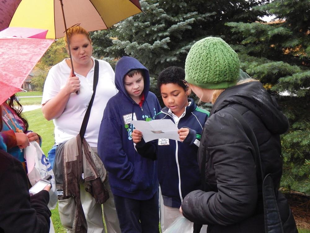
Courtesy / Kin Ma Shawmut Hills students participating in National GIS (Geographic Information Systems) Day
Nov 2, 2013
About 40 sixth-graders used Grand Valley State University’s geographical information systems lab on Thursday to locate the possible remains of Amelia Earhart’s lost plane on Gardner Island, now called Nikumaroro Island, in the Pacific Ocean northeast of Australia.
Granted, the International Group for Historic Aircraft Recovery found the evidence first, but these Shawmut Hills students were able to use the same technology as TIGHAR to re-create the steps that led TIGHAR to the possible wreckage.
“Huffington Post just announced that they believe they found the wreckage of her plane just off the coast of Nikumaroro Island in the Republic of Kiribati,” said Diane Panaccio, the president of the Association of Student Geographers and Planners at GVSU. “Exactly where our mapping technology projected it should be.”
Guided by Panaccio, the students used the ArcMap program to plot and study Earhart’s last flight. ArcMap is one of the main elements of ArcGIS, a group of geospatial processing programs used by GVSU in the GIS program. It is capable of creating maps with which users can view, edit and analyze geospatial data.
“We teach (the students) about how useful geographical information systems can be and how you can use maps to do creative things and scholarly things,” said James Penn, professor in the Department of Geography and Planning. “Several of the kids said that they really enjoyed the experience and, ‘I want to come here when I’m older.’”
The sixth-graders were split into two groups for the event; while one group was in the lab tracking Earhart, the other was outside geocaching for Halloween candy with a set of coordinates designed to mimic Earhart’s flight.
“I walked with the student groups as they did GPS geocaching,” said professor Kin Ma, the organizer of the event. “GVSU Geography and Planning has been hosting these GIS Geographic Awareness Days since 2003. We adapted the event to our schedules so that it was hosted today.”
Even with unexpected rain and programming errors, the event was successful.
“The most difficult part was some technological difficulties we had with some of the GIS software and the technical units we had,” said Nathaniel McComb, a member of the ASGP. “I really liked interacting with the kids and helping them understand what GIS is and the practical applications of it.”
Ian Swanson, 11, participated in the GIS day and said he likes GPS systems better than maps.
“It was really fun using the technology,” he said. “It’s different using GPS and the maps—it’s more helpful. I love coordinates.”
Students interested in seeing maps made with the ArcMap program and other GIS software can find out more during GVSU’s GIS week, which is part of the National Geographic Awareness Week. An information table will be set up in the lobby of the Kirkhof Center from 11 p.m. to 2 p.m. on Nov. 21.